
.jpg) 8 hours ago
1
8 hours ago
1
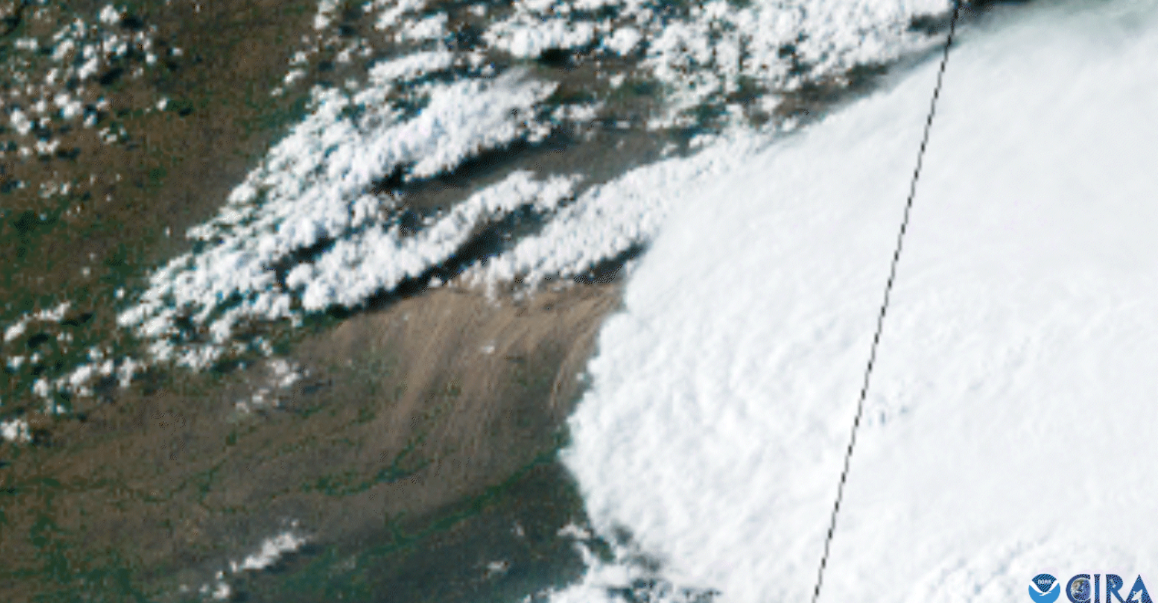
In mid-May, a giant wall of dust paraded across parts of the U.S. Midwest, and, thanks to the National Oceanic and Atmospheric Administration (NOAA)'s Geostationary Operational Environmental Satellite (GOES) East satellite, we were able to follow along.
In mid-May, a giant wall of dust paraded across parts of the U.S. Midwest, and, thanks to the National Oceanic and Atmospheric Administration (NOAA)'s Geostationary Operational Environmental Satellite (GOES) East satellite, we were able to follow along.
The GOES-19 spacecraft, which has been in space for less than a year after launching in late June 2024, took over the GOES East spot back in April. Hanging out at 22,236 miles (35,785 kilometers) above the planet, the next-gen satellite watches over the Western Hemisphere; it keeps a close eye on our weather, takes measurements to study our climate and monitors and tracks wildfires as they develop.
In addition, by being in the right place at the right time, GOES East can document historic weather events from beginning to end.
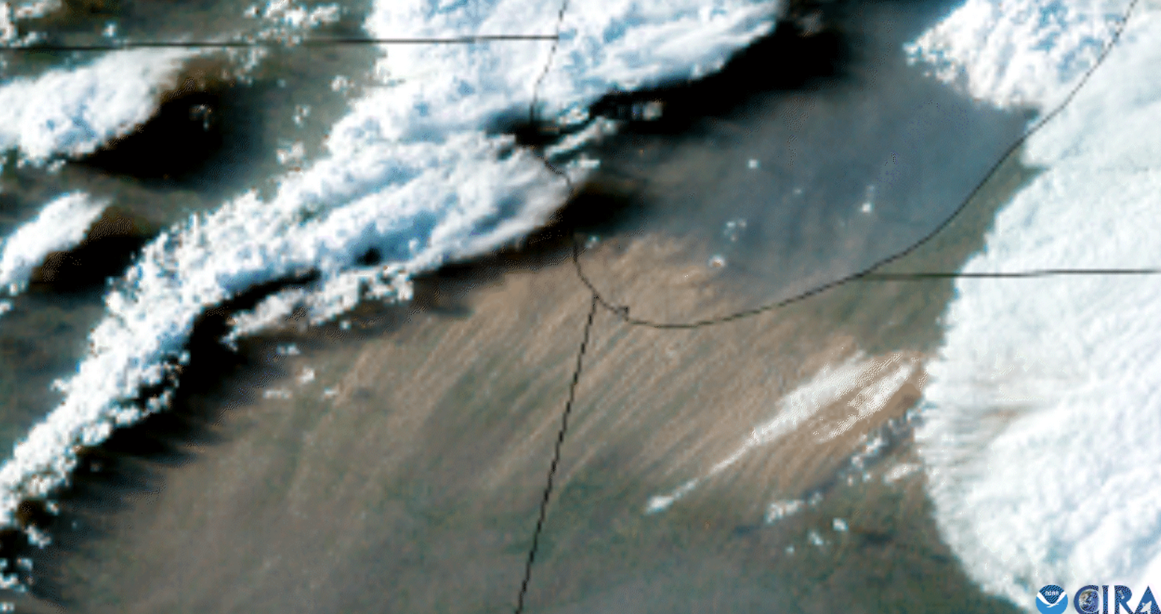
Dust storms are pretty rare across the Great Lakes region, but on May 16, one developed across northern Illinois and proceeded east through metropolitan Chicago and northern Indiana.
It sprang from a group of severe thunderstorms in central Illinois, as strong winds began to kick up dust on dry farmland. As the storms progressed east, a massive dust cloud formed, situating itself just behind the front edge of the outflow winds of the thunderstorm.
The powerful winds continued to drive the dust storm, with gusts reaching more than 60 mph (97 kph) at times.
This part of the country is more accustomed to Snow Squall Warnings, in which intense bands of snow can drop visibility quickly to zero and are accompanied by howling winds. But this time, it was the curtain of dust, not snow, that prompted the National Weather Service (NWS) Forecast Office in Chicago to issue alerts, with visibilities reaching close to zero at several instances.
Throughout the event, four separate Dust Storm Warnings were released, with the criteria of winds of at least 20 mph (32 kph) paired with widespread blowing dust, dropping the visibility to 0.25 miles (0.4 kilometers) or less.
While dust storms are not common throughout the Midwest, they're extremely rare in the Windy City. The most recent dust storm to affect Chicago took place on May 31, 1985, but it was nowhere near the strength of this one.
The NWS Chicago office confirmed that it's been close to a century since the city was hit with an event of this proportion; that storm took place in the early to mid-1930s, during the Dust Bowl era.
 English (US)